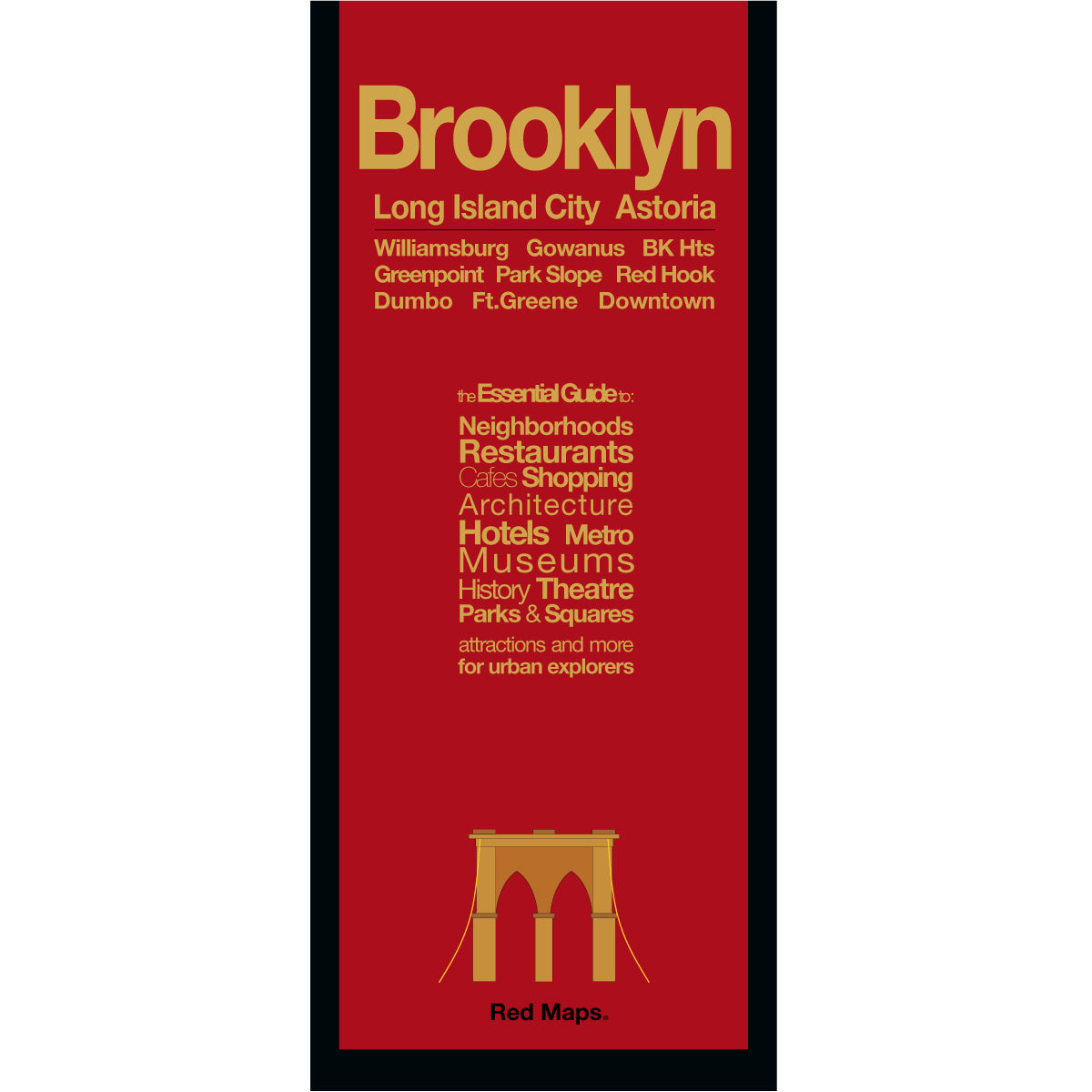
BROOKLYN Neighborhoods Street Map
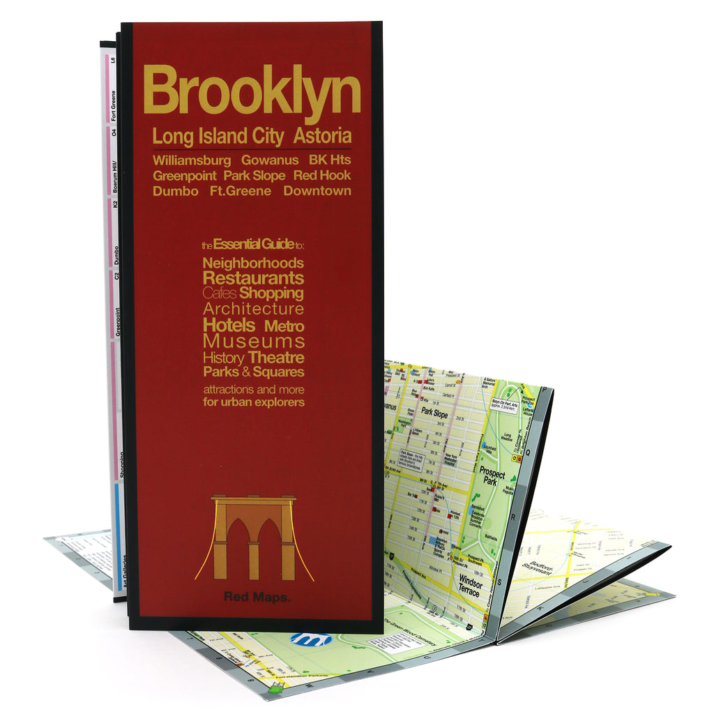
Foldout Travel Map to Brooklyn
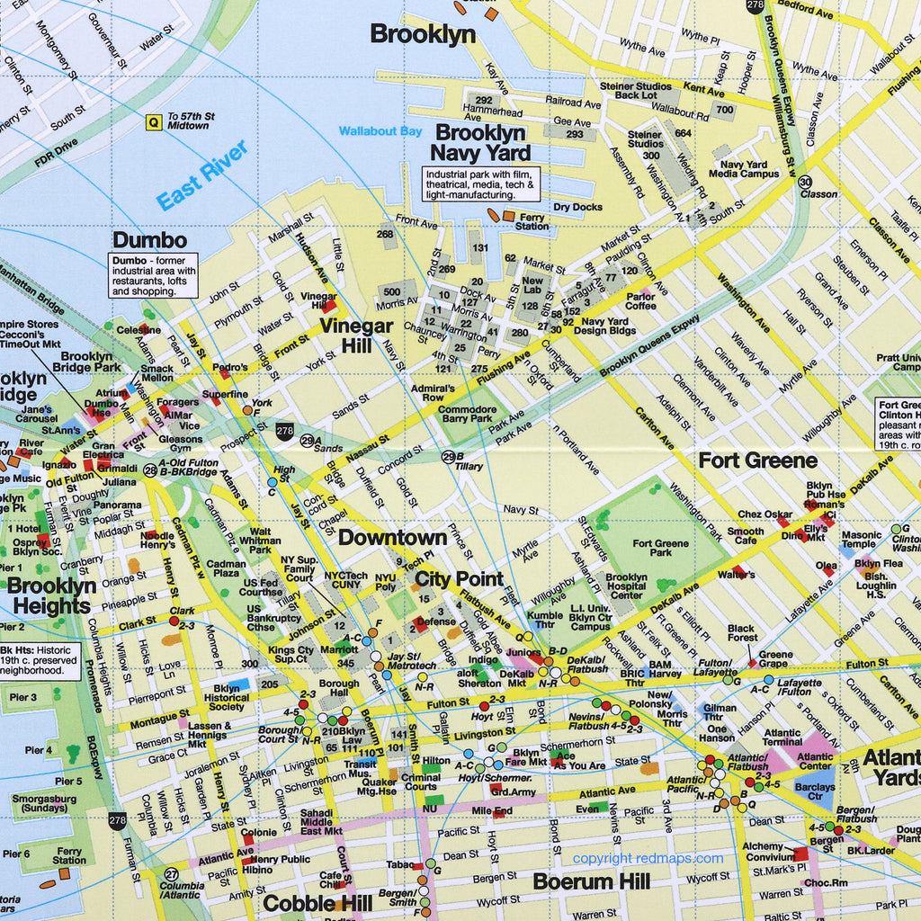
Experience and discover everything you've heard about Brooklyn's culture, restaurants and art scenes with the Red Map. Concisely organized to get you quickly on your way to the famous shops, cafes and neighborhoods you've seen on TV and in the movies. A special map of Long Island City, Queens is included with its own popular attractions, restaurants and cultural points of interest.
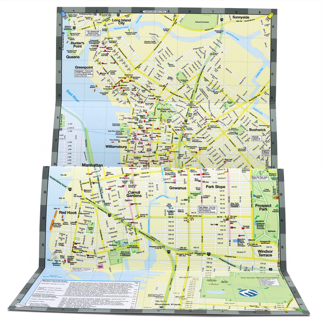
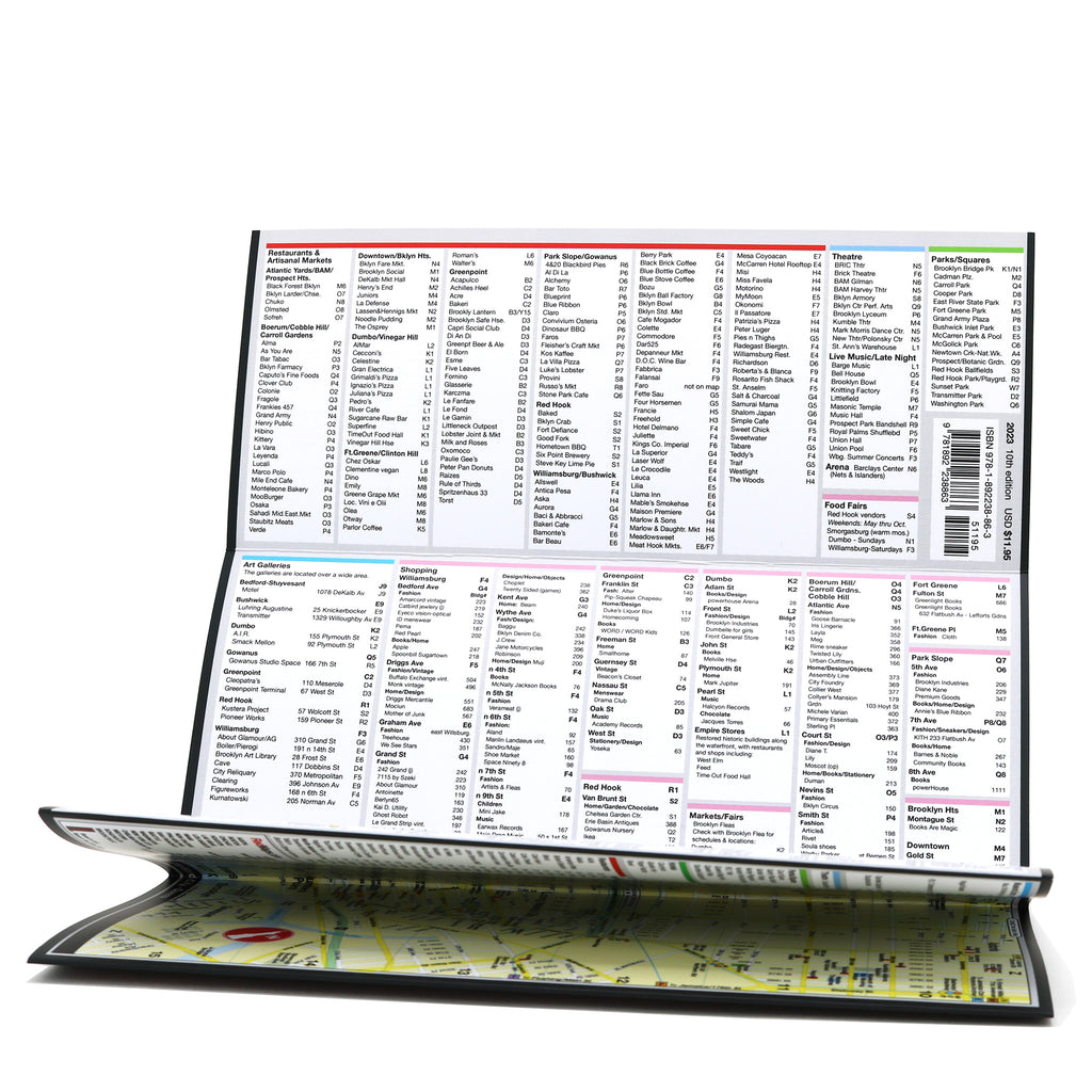
Information on the Map:
Popular attractions & points of interest.
Museums with collection highlights.
Landmarks and monuments.
Brief historical descriptions.
Restaurants, cafes & food halls.
Local shops and merchants.
Parks and gardens
Movie Studios
NYC Subway stations.
Neighborhoods on the Map
Williamsburg, Greenpoint, Dumbo, Brooklyn Heights, Downtown Brooklyn, City Point, Fort Greene, Park Slope, Boerum Hill, Red Hook, Carroll Gardens, Bushwick, plus Long Island City and Astoria, Queens.
Map Dimensions:
Opens to 24 in. wide x 9.5 in. tall; 61 cm x 19 cm.
Map folds to 4 in. wide x 9.5 in. tall; 24 cm x 19 cm.
No-glare matte laminated finish makes the map easy-to-read indoors and outdoors.
Travel Tips and Ideas for Brooklyn
Customer Reviews
The Story of Red Maps City Guides
What is a Red Map?
Red Maps are travel maps to cities in the United States and Europe. Each Red Map provides a traveler with a comprehensive guide a city’s cultural attractions and places of interest. Red Maps have clear-graphics and easy-to-read, concisely-organized information. Red Maps are known as a very stylish guide to have, and have been recommended in over 100 magazines and newspapers.What Information is on a Red Map?
Why are Red Maps the Best Map?
The Story of how Red Maps Began
The story of Red Maps began when I was working at a job in real estate...One lucky day, while drawing a map to show a client the locations of shops along Miami Beach’s Lincoln Road, a colleague passed my desk, saw my drawing, and casually mentioned that I had a talent for cartography. She suggested that I make maps professionally.
Giving it some thought, I proceeded to try just that. Each day after work I would teach myself computer-graphics by reading one chapter from an Adobe Illustrator manual. It took over one year’s time to produce the first Red Maps for sale in May of 1998.
Jim Leniart
Owner/Creative Director