LAS VEGAS STRIP City Map
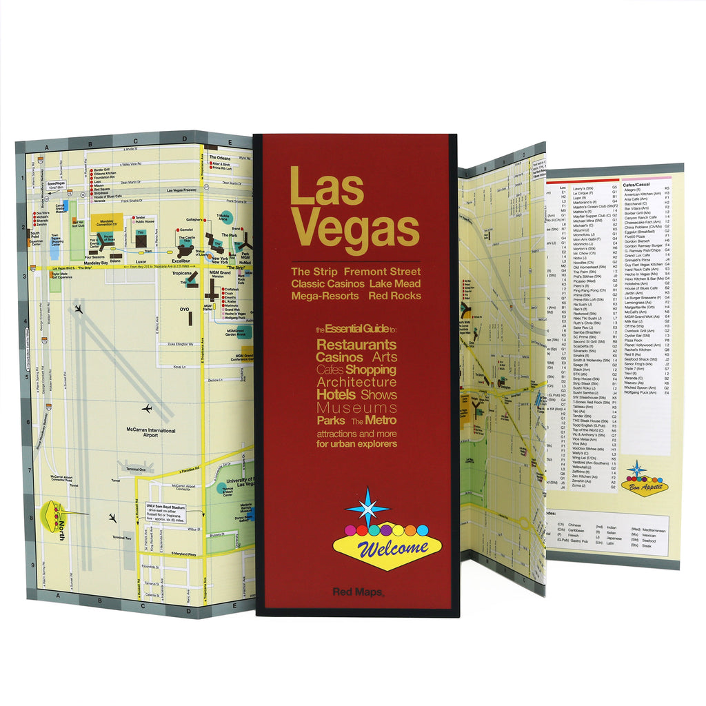
Travel Map for Las Vegas
Explore Vegas's resorts and most popular attractions with this pocket-size foldout map. Experience Vegas' rich history, indulge yourself in lavish restaurants, superstar entertainment, endless shopping, and the beauty of nearby Red Rocks and the Hoover Dam. Get ready to party!
Information on the Las Vegas Map:
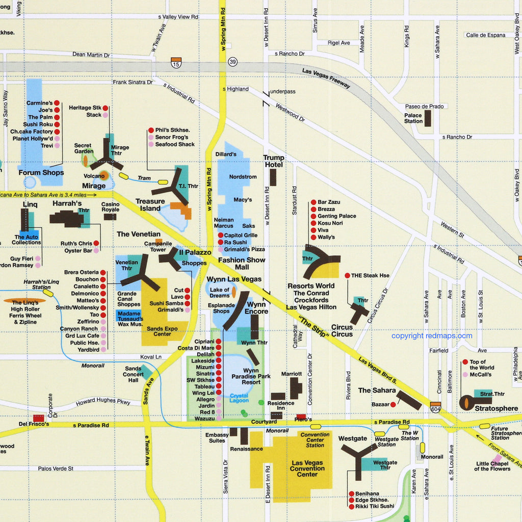
Best Vegas restaurants and cuisines.
Convention and meeting centers.
Landmarks and points of interest.
Theaters, sports arenas and stadiums.
Luxury shopping centers and boutiques.
Monorail stations shown on map.
Special map of nearby national parks and attractions.
City and Nearby Natural Attractions on the Map
Central Las Vegas, The Strip, Fremont Street, Las Vegas Civic Center, Lake Mead, Hoover Dam, Red Rock Canyon National Recreation Area, Toiyabe National Forest, Mt. Charleston Recreation Area and Valley of Fire.
Map Dimensions:
Opens to 24 in. wide x 9.5 in. tall; 61 cm x 19 cm.
Map folds to 4 in. wide x 9.5 in. tall; 24 cm x 19 cm.
No-glare matte laminated finish makes the map easy-to-read indoors and outdoors.
Travel Tips and Ideas for Las Vegas:
The Story of Red Maps City Guides
What is a Red Map?
Red Maps are travel maps to cities in the United States and Europe. Each Red Map provides a traveler with a comprehensive guide a city’s cultural attractions and places of interest. Red Maps have clear-graphics and easy-to-read, concisely-organized information. Red Maps are known as a very stylish guide to have, and have been recommended in over 100 magazines and newspapers.What Information is on a Red Map?
Why are Red Maps the Best Map?
The Story of how Red Maps Began
The story of Red Maps began when I was working at a job in real estate...One lucky day, while drawing a map to show a client the locations of shops along Miami Beach’s Lincoln Road, a colleague passed my desk, saw my drawing, and casually mentioned that I had a talent for cartography. She suggested that I make maps professionally.
Giving it some thought, I proceeded to try just that. Each day after work I would teach myself computer-graphics by reading one chapter from an Adobe Illustrator manual. It took over one year’s time to produce the first Red Maps for sale in May of 1998.
Jim Leniart
Owner/Creative Director