


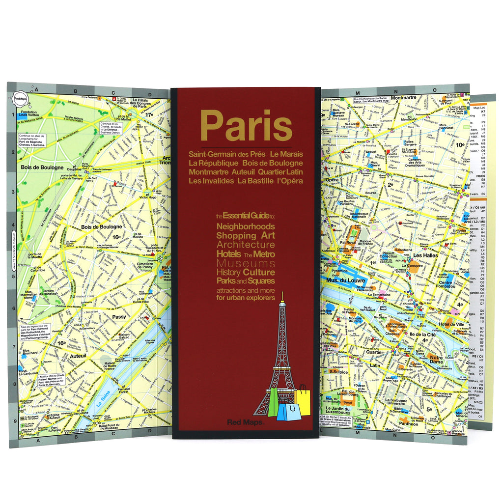
PARIS City Center Map
Foldout Travel Map of Paris
Laminated pocket-sized map of central Paris shows you in one easy-to-read colorful map everything you'll want to see the City of Lights.
Information on the Map Includes:
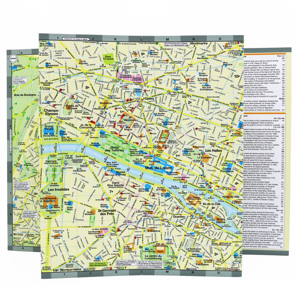
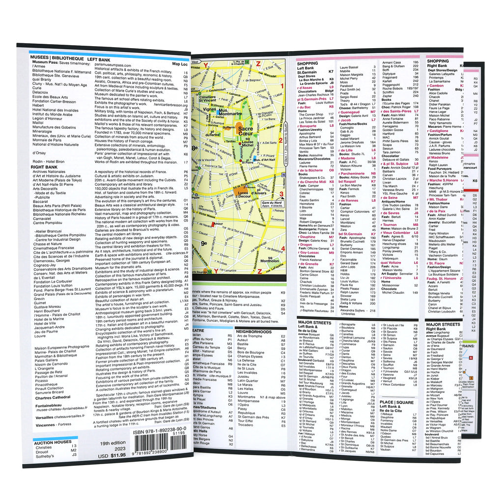
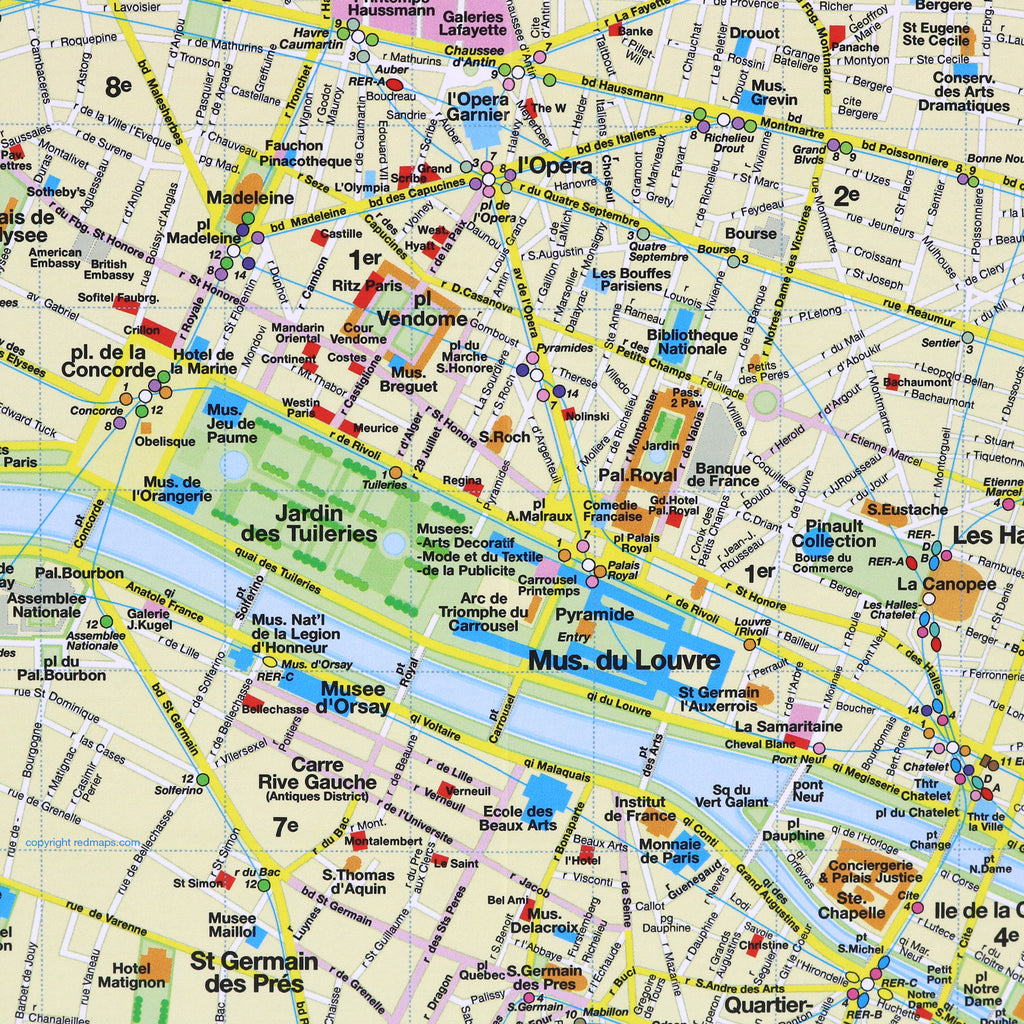
Important historical landmarks.
Useful facts about Paris' popular attractions.
Museum collection highlights.
Central Paris boutique hotels.
Right and Left Bank Shopping
Streets & squares clearly identified.
Charming local Paris merchants.
Metro stations & routes shown on map.
Parks, theatres and stadiums.
Neighborhoods on this Map
Paris Red Map shows these neighborhoods: Le Marais, Montmarte, Les Halles, l'Opera, Champs-Elysees, St. Germain des Pres, Latin Quarter, La Republique, Eiffel Tower and Bois de Bologne.
Map Dimensions
Opens to 24 in. wide x 9.5 in. tall; 61 cm x 19 cm
Map folds to 4 in. wide x 9.5 in. tall; 24 cm x 19 cm
No-glare matte finish, easy-to-read map indoors and outdoors.