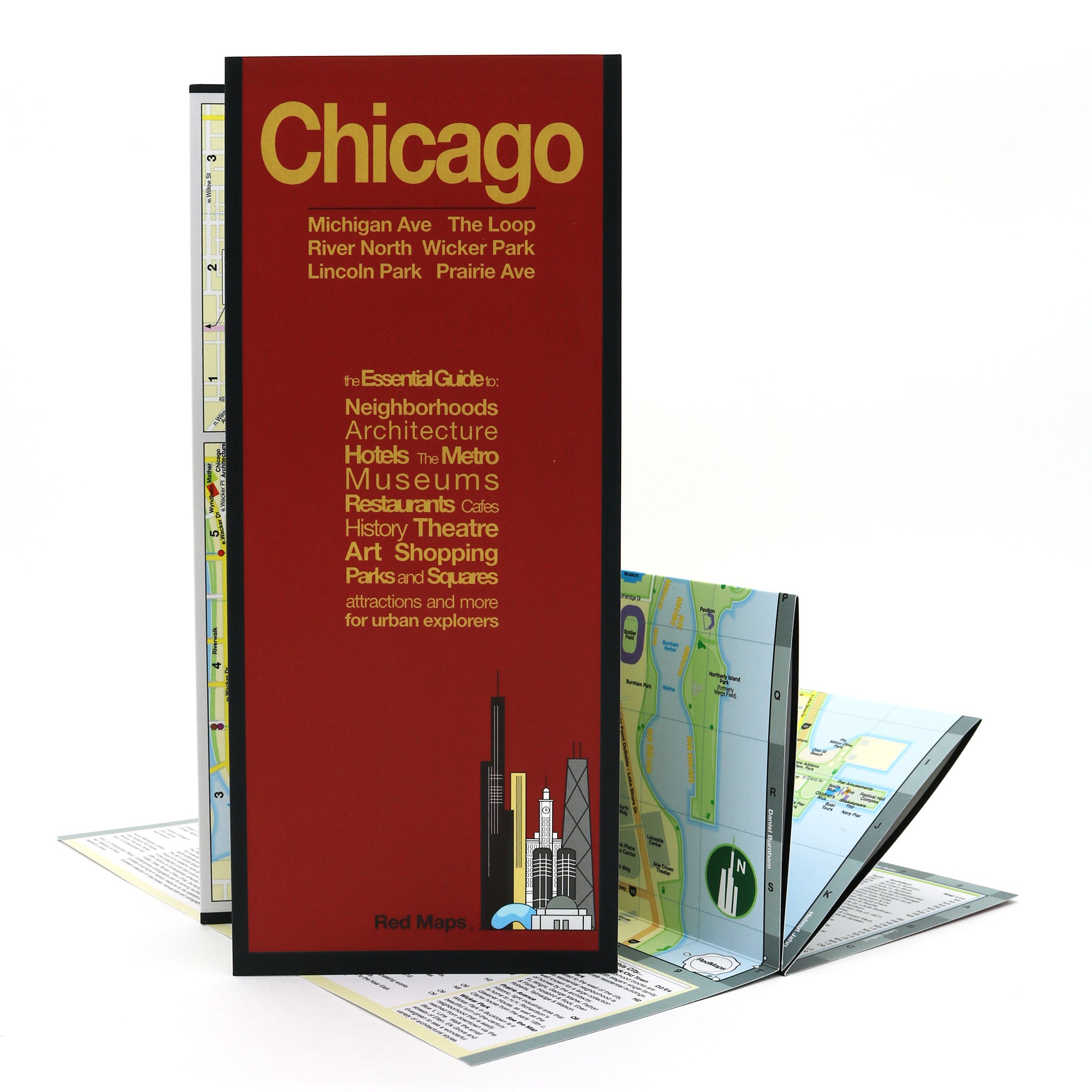
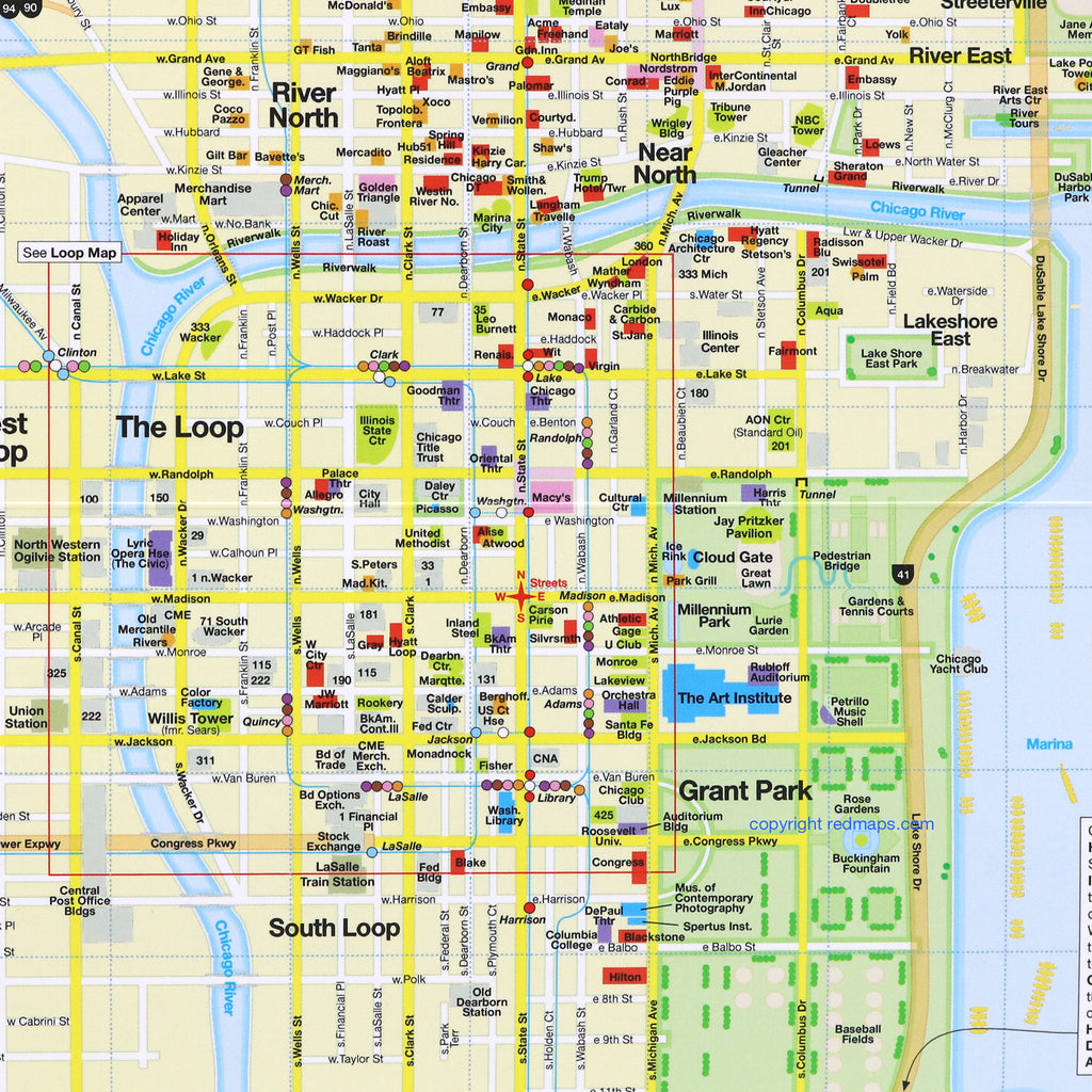
CHICAGO City Center Map
Foldout Travel Map for Chicago
Discovering Chicago's rich history and hidden treasures is easy with this user-friendly folding travel map. Learn about the Windy City’s famous architecture, enjoy its Broadway Theatres and indulge in the lively restaurant scene. Get ready for a vacation of a lifetime!
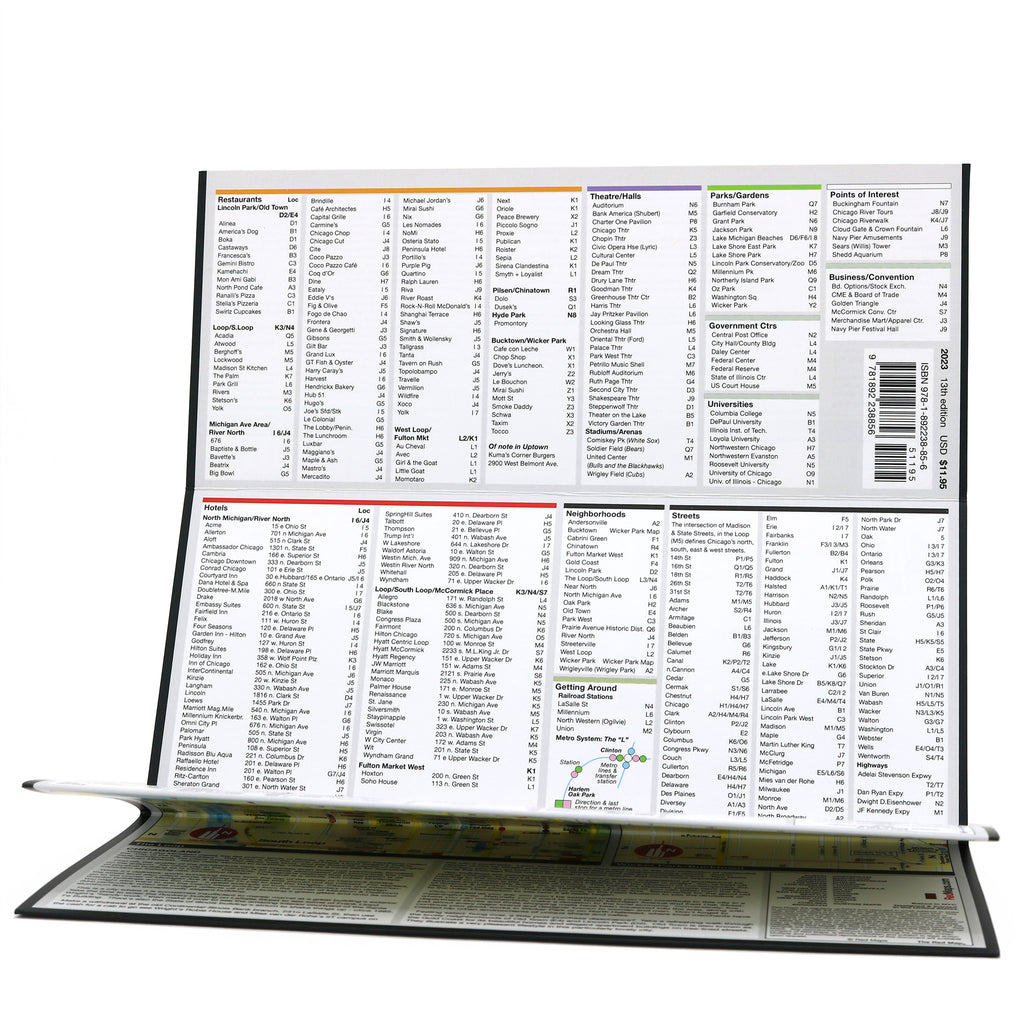
Information on the Map:
Popular attractions and points of interest.
Brief history insights and descriptions.
Restaurants and cafes.
Centrally located hotels.
Important architectural landmarks.
Art museums' collection highlights.
Chicago L metro stations and routes.
Outdoor spaces and parks.
Local and luxury shopping on Michigan Ave.
Special zoom-in maps of The Loop and Wicker Park areas.
Neighborhoods on the Chicago Map
Fulton Market West, Lincoln Park, the Gold Coast, The Loop, Near North, North Michigan Ave, Old Town, Prairie Avenue Historic District, River North, West Loop and Wicker Park.
Map Dimensions:
Opens to 24 in. wide x 9.5 in. tall; 61 cm x 19 cm.
Map folds to 4 in. wide x 9.5 in. tall; 24 cm x 19 cm.
No-glare matte finish makes the map easy-to-read indoors and outdoors.
Travel Tips and Articles about Chicago
Customer Reviews
The Story of Red Maps City Guides
What is a Red Map?
Red Maps are travel maps to cities in the United States and Europe. Each Red Map provides a traveler with a comprehensive guide a city’s cultural attractions and places of interest. Red Maps have clear-graphics and easy-to-read, concisely-organized information. Red Maps are known as a very stylish guide to have, and have been recommended in over 100 magazines and newspapers.What Information is on a Red Map?
Why are Red Maps the Best Map?
The Story of how Red Maps Began
The story of Red Maps began when I was working at a job in real estate...One lucky day, while drawing a map to show a client the locations of shops along Miami Beach’s Lincoln Road, a colleague passed my desk, saw my drawing, and casually mentioned that I had a talent for cartography. She suggested that I make maps professionally.
Giving it some thought, I proceeded to try just that. Each day after work I would teach myself computer-graphics by reading one chapter from an Adobe Illustrator manual. It took over one year’s time to produce the first Red Maps for sale in May of 1998.
Jim Leniart
Owner/Creative Director