NEW ORLEANS City Travel Map
Foldout Travel Map for New Orleans
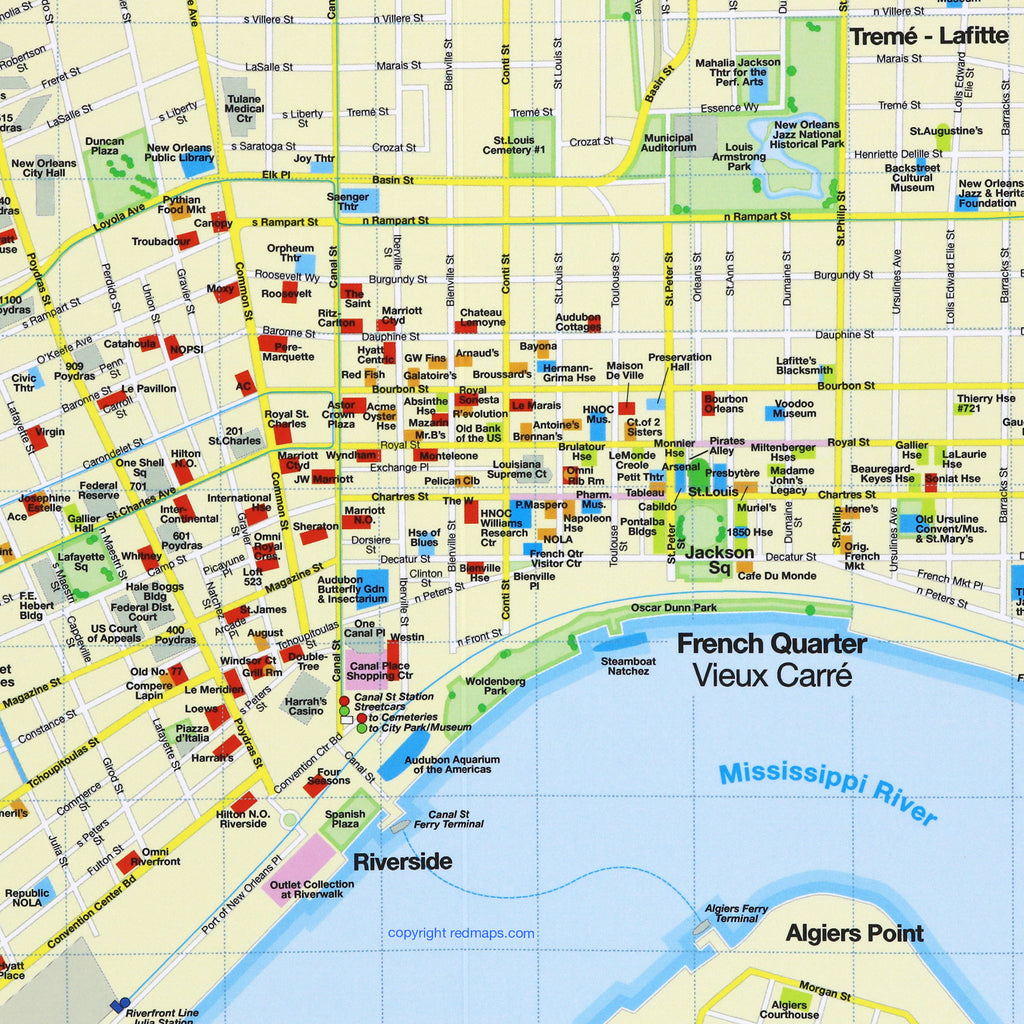
Explore historic New Orleans and indulge in its famous Creole and Cajun restaurants with the Red Map. Tour the Garden District's historic mansions, hear live music in the French Quarter, and walk under 200 year old giant oak trees. There is no other city like New Orleans!
Information on the Map:
Popular attractions and points of interest.
Famous restaurants and cafes.
Garden District monuments and mansions.
French Quarter live music venues.
Brief historical insights and descriptions.
Centrally located hotels.
Famous streetcar routes shown on map.
Museums' collection highlights.
Local shops and merchants.
Neighborhoods on the New Orleans Map
French Quarter, Garden District, Audubon Park, New Orleans City Park and the Fair Grounds, Treme-Lafitte, Loyola, Central Business District, St. Claude and Uptown.
Map Dimensions:
Opens to 24 in. wide x 9.5 in. tall; 61 cm x 19 cm.
Map folds to 4 in. wide x 9.5 in. tall; 24 cm x 19 cm.
No-glare matte laminated finish makes the map easy-to-read indoors and outdoors.
Travel Tips and Articles about New Orleans
The Story of Red Maps City Guides
What is a Red Map?
Red Maps are travel maps to cities in the United States and Europe. Each Red Map provides a traveler with a comprehensive guide a city’s cultural attractions and places of interest. Red Maps have clear-graphics and easy-to-read, concisely-organized information. Red Maps are known as a very stylish guide to have, and have been recommended in over 100 magazines and newspapers.What Information is on a Red Map?
Why are Red Maps the Best Map?
The Story of how Red Maps Began
The story of Red Maps began when I was working at a job in real estate...One lucky day, while drawing a map to show a client the locations of shops along Miami Beach’s Lincoln Road, a colleague passed my desk, saw my drawing, and casually mentioned that I had a talent for cartography. She suggested that I make maps professionally.
Giving it some thought, I proceeded to try just that. Each day after work I would teach myself computer-graphics by reading one chapter from an Adobe Illustrator manual. It took over one year’s time to produce the first Red Maps for sale in May of 1998.
Jim Leniart
Owner/Creative Director