




Las Vegas Strip Map: Laminated City & Resort Guide
Laminated Street & Casino Map for Las Vegas
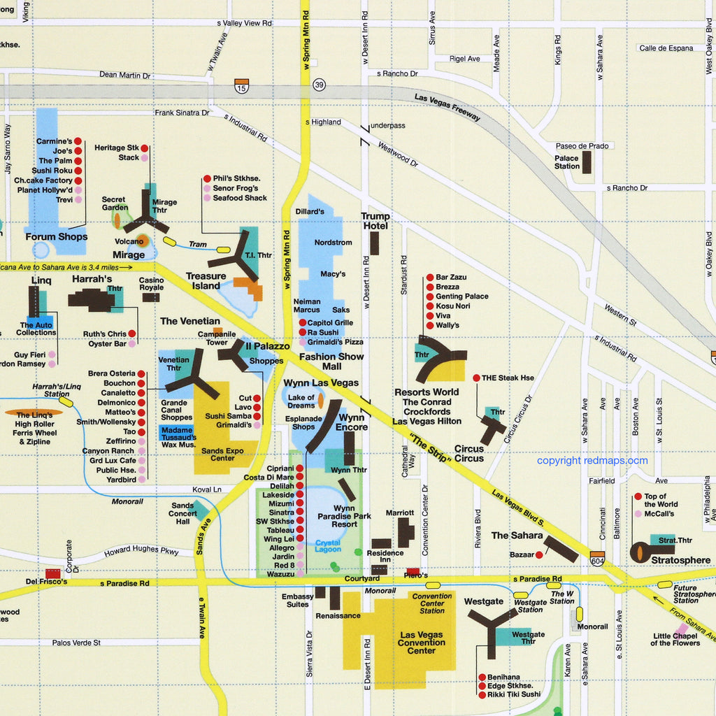
Explore the Strip, Downtown Fremont Street, and iconic casino resorts with this pocket-sized, laminated foldout map. Effortlessly navigate world-class dining, monorail stops, and entertainment at the Sphere, local arenas, and theatres. Find luxury shopping at The Shops at Crystals, Wynn, and Bellagio resorts, plus nearby escapes like Red Rock Canyon and the Hoover Dam.
FEATURED ON THE LAS VEGAS MAP
Top Vegas restaurants and dining destinations.
Convention, expo, and meeting centers.
Iconic landmarks, casino resorts, and points of interest.
Theaters, sports arenas, and stadiums.
Luxury shopping centers and designer boutiques.
Las Vegas Monorail stations clearly marked.
Special regional map of nearby national parks and attractions.
NEARBY NATURAL ATTRACTIONS ON THE MAP
Lake Mead, Hoover Dam, Red Rock Canyon National Conservation Area, Toiyabe National Forest, Mt. Charleston Recreation Area, and Valley of Fire State Park.
NEIGHBORHOODS ON THE MAP
The Las Vegas Strip, Fremont Street, Downtown Las Vegas, and the Civic Center, featuring an inset map of the greater Las Vegas metropolitan area.
TRAVELERS ALSO PAIR WITH
Las Vegas is frequently paired with the Los Angeles Map—or if planning trips to sun-filled destinations like Miami, Los Angeles, Barcelona, and New Orleans, the Sunny Days 5-Map Set for built-in set savings.
WHAT TRAVELERS SAY ABOUT USING RED MAPS
“I appreciate the care you take in your wrapping of the maps; the cards with the Pantheon for Rome and Ponte Vecchio for Florence are a lovely touch. Thank you.”
— Customer, British Columbia, CANADA
“I used your London and Paris Red Maps and found them very useful, so I ordered Vienna. I like these maps, I can actually read the street names and landmarks without having to squint!”
— Customer, Seattle, WA
AS SEEN IN & RECOMMENDED BY
Travel + Leisure, The New York Times, British Vogue, Harper's Bazaar, Condé Nast Traveller, ELLE, Wallpaper*, Town & Country, The Washington Post, The Wall Street Journal, Highsnobiety, and Madame Figaro — among over 100 purveyors of style, travel & design.
MAP DIMENSIONS & MATERIALS
Opens to 24 in. wide x 9.5 in. tall | 61 cm x 24 cm
Map folds to a compact 4 in. wide x 9.5 in. tall | 10 cm x 24 cm
Printed on premium cover-weight stock.
No-glare matte laminated finish, easy to read indoors and outdoors.