


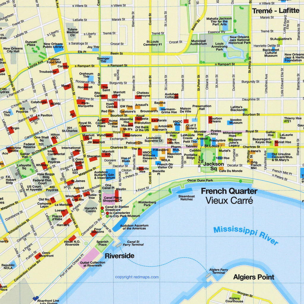
NEW ORLEANS Street Map: French Quarter & Garden District
The Essential Pocket Street Map for Historic New Orleans
Immerse yourself in the soulful charm of New Orleans, where live jazz spills into twilight streets and the scent of authentic Creole cooking fills the air. Wander beneath moss-draped, 200-year-old oak trees, admire the ornate ironwork balconies of the historic French Quarter, and discover magnificent antebellum mansions throughout the picturesque Garden District.
From vibrant Bourbon Street nightlife to hidden neighborhood courtyards, explore the crescent city with ease.
FEATURED ON THE NEW ORLEANS MAP
Popular attractions & historic landmarks.
Creole & Cajun restaurants.
French Quarter jazz clubs.
Garden District mansions.
Iconic streetcar lines and their routes.
Museums with collection highlights highlights.
Boutique hotels & inns.
Local shops & antique stores.
Brief historical overviews.
NEIGHBORHOODS ON THE MAP
French Quarter, Garden District, Audubon Park, New Orleans City Park and the Fair Grounds, Treme-Lafitte, Loyola, Central Business District, St. Claude and Uptown.
TRAVELERS ALSO PAIR WITH
New Orleans is frequently paired with the New Orleans Notecard Set—or if exploring sun-filled party destinations like Miami, Los Angeles, Las Vegas, and Barcelona, the Sunny Days 5-Map Set for built-in set savings.
WHAT TRAVELERS SAY ABOUT USING RED MAPS
“I appreciate the care you take in your wrapping of the maps; the cards with the Pantheon for Rome and Ponte Vecchio for Florence are a lovely touch. Thank you.”
— Customer, British Columbia, CANADA
“I used your London and Paris Red Maps and found them very useful, so I ordered Vienna. I like these maps, I can actually read the street names and landmarks without having to squint!”
— Customer, Seattle, WA
AS SEEN IN & RECOMMENDED BY
Travel + Leisure, The New York Times, British Vogue, Harper's Bazaar, Condé Nast Traveller, ELLE, Wallpaper*, Town & Country, The Washington Post, The Wall Street Journal, Highsnobiety, and Madame Figaro — among over 100 purveyors of style, travel & design.
MAP DIMENSIONS & MATERIALS
Opens to 24 in. wide x 9.5 in. tall | 61 cm x 24 cm
Map folds to a compact 4 in. wide x 9.5 in. tall | 10 cm x 24 cm
Printed on premium cover-weight stock.
No-glare matte laminated finish, easy to read indoors and outdoors.