


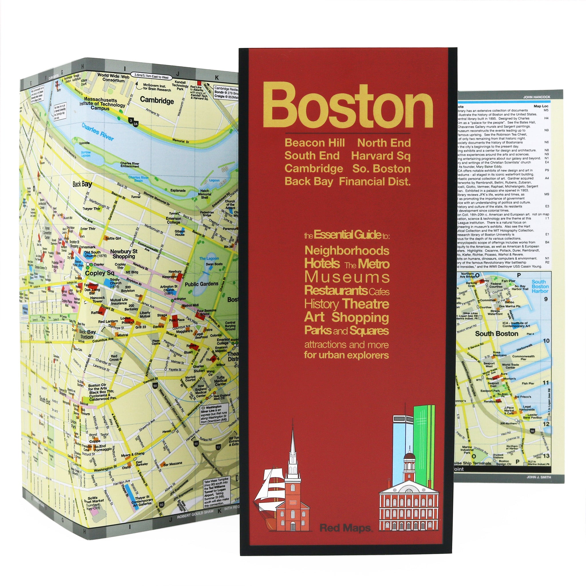

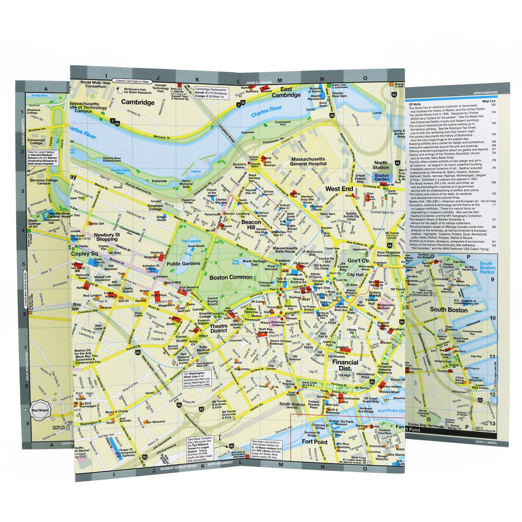

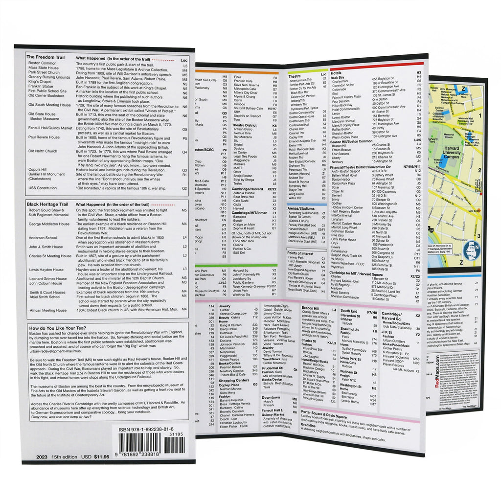


Boston City Center Map
Exploring the Boston City Center: Landmarks & Attractions
Boston's history doesn't stay in the history books — it's written into every cobblestone street, Revolutionary War monument, and neighborhood corner. This Red Map puts the Freedom Trail, the Black Heritage Trail, historic landmarks, and world-class museums right in your pocket, across all 11 of Boston's most walkable neighborhoods.
NEIGHBORHOODS ON THE MAP
Beacon Hill, Back Bay, Harvard Square, North End, South End, South Boston, Fenway, Boston Financial District, Theatre District, Boston Convention Center and Fort Point.
KEY FEATURES OF THE RED MAP BOSTON
Historic landmarks and popular attractions.
Freedom Trail points of interest.
Black Heritage Trail landmarks.
American Revolution monuments and Paul Revere sites.
Museum and gallery highlights with collection descriptions.
Boutique and centrally located hotels.
Restaurants, cafes, and Boston shopping.
Outdoor spaces and parks.
Boston T subway stations.
Historical facts and descriptions for key landmarks.
AS SEEN IN AND RECOMMENDED BY
Travel + Leisure, The New York Times, British Vogue, Harper's Bazaar, Condé Nast Traveller, ELLE, Wallpaper*, Town & Country, The Washington Post, The Wall Street Journal, Highsnobiety, and Madame Figaro — among over 100 purveyors of style, travel & design.
MAP DIMENSIONS
Opens to 24 in. wide x 9.5 in. tall | 61 cm x 19 cm.
Map folds to 4 in. wide x 9.5 in. tall | 24 cm x 19 cm.
No-glare matte laminated finish — easy to read indoors and outdoors.