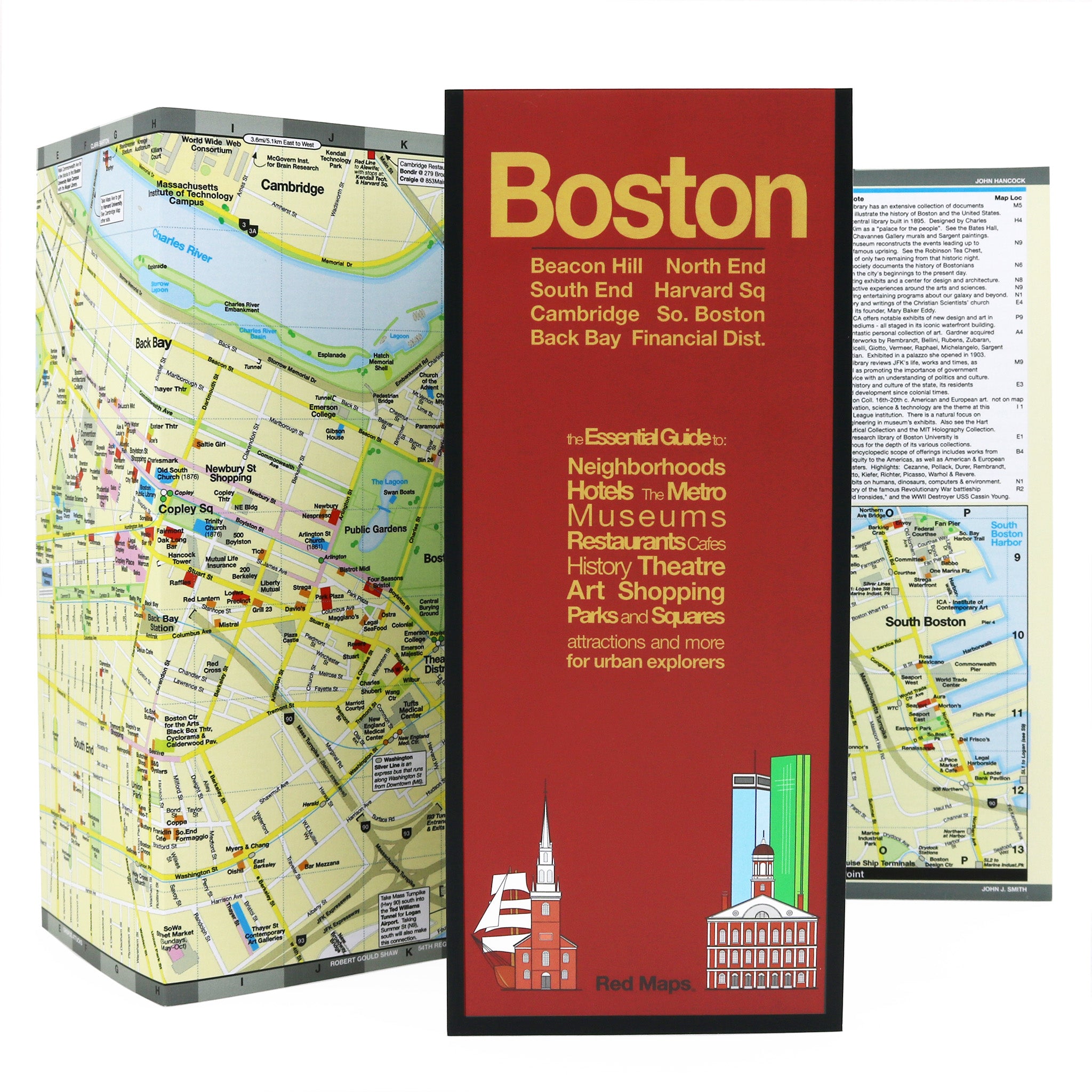
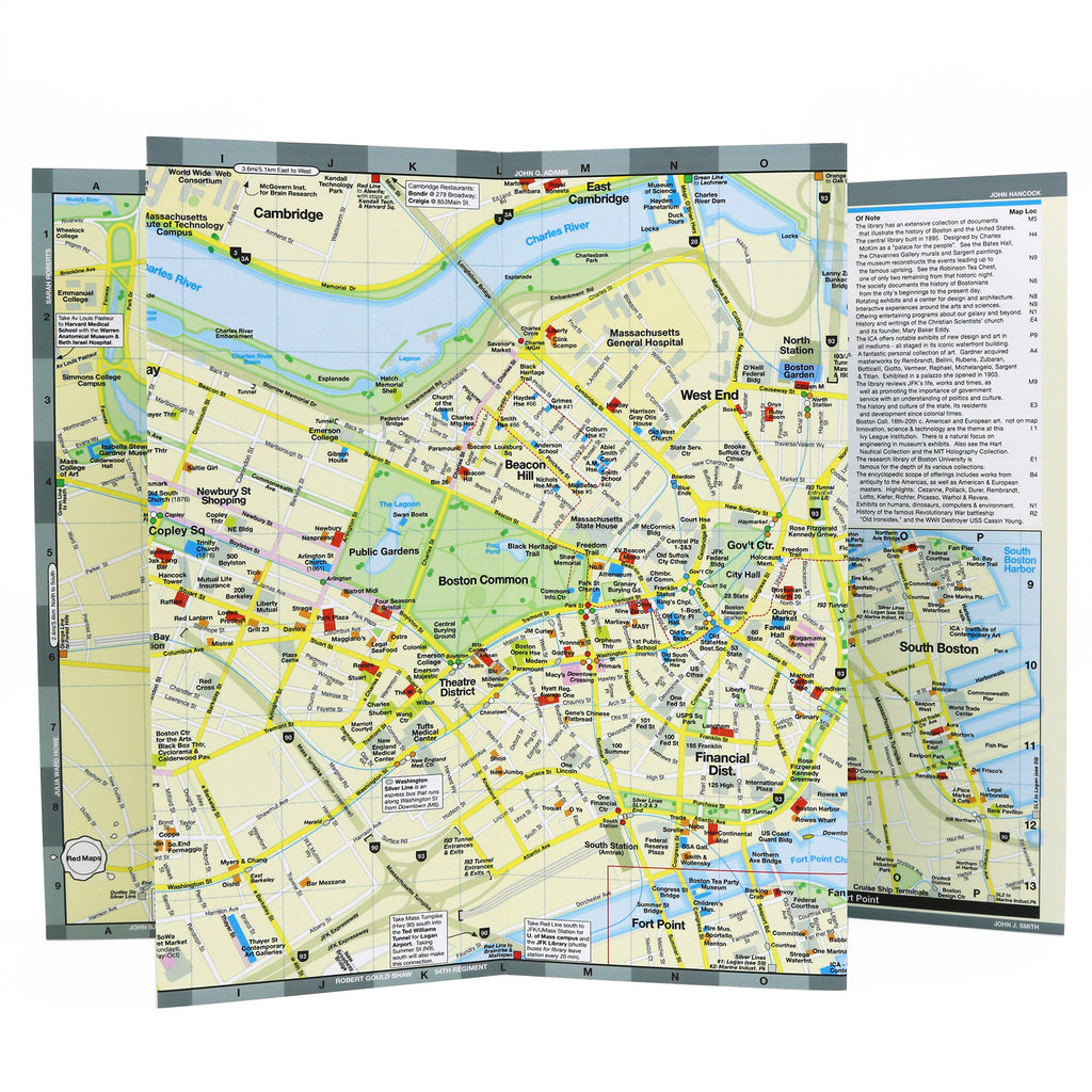
BOSTON City Center Map
Foldout Travel Map for Boston
Discover Boston's rich history with our pocket-sized travel map. Follow in the foot-steps of the Freedom and Black Heritage Trails with helpful insights and descriptions, stroll the city's charming neighborhoods and enjoy Boston's rich restaurant scene. You won't miss a thing, and you'll have the vacation of a lifetime!
Information on the Map:
Popular attractions & points of interest.
Restaurants and cafes.
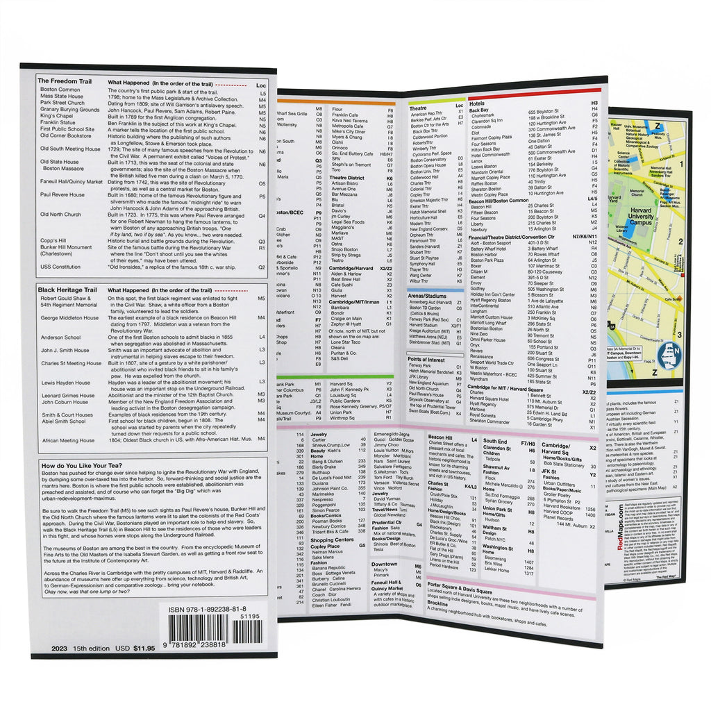
American Revolution monuments.
Black Heritage Trail landmarks.
Freedom Trail points of interest.
Helpful brief history tips.
Highlights of museums' art collections.
Centrally located hotels.
Outdoor spaces and Boston’s parks.
Boston T subway stations shown on map.
Boston shopping.
Neighborhoods on the Boston Map
Beacon Hill, Back Bay, Harvard Square, North End, South End, South Boston, Fenway, Boston Financial District, Theatre District, Boston Convention Center and Fort Point.
Map Dimensions:
Opens to 24 in. wide x 9.5 in. tall; 61 cm x 19 cm.
Map folds to 4 in. wide x 9.5 in. tall; 24 cm x 19 cm.
No-glare matte laminated finish; easy-to-read indoors and outdoors.
Travel Tips and Articles about Boston
Customer Reviews
The Story of Red Maps City Guides
What is a Red Map?
Red Maps are travel maps to cities in the United States and Europe. Each Red Map provides a traveler with a comprehensive guide a city’s cultural attractions and places of interest. Red Maps have clear-graphics and easy-to-read, concisely-organized information. Red Maps are known as a very stylish guide to have, and have been recommended in over 100 magazines and newspapers.What Information is on a Red Map?
Why are Red Maps the Best Map?
The Story of how Red Maps Began
The story of Red Maps began when I was working at a job in real estate...One lucky day, while drawing a map to show a client the locations of shops along Miami Beach’s Lincoln Road, a colleague passed my desk, saw my drawing, and casually mentioned that I had a talent for cartography. She suggested that I make maps professionally.
Giving it some thought, I proceeded to try just that. Each day after work I would teach myself computer-graphics by reading one chapter from an Adobe Illustrator manual. It took over one year’s time to produce the first Red Maps for sale in May of 1998.
Jim Leniart
Owner/Creative Director