


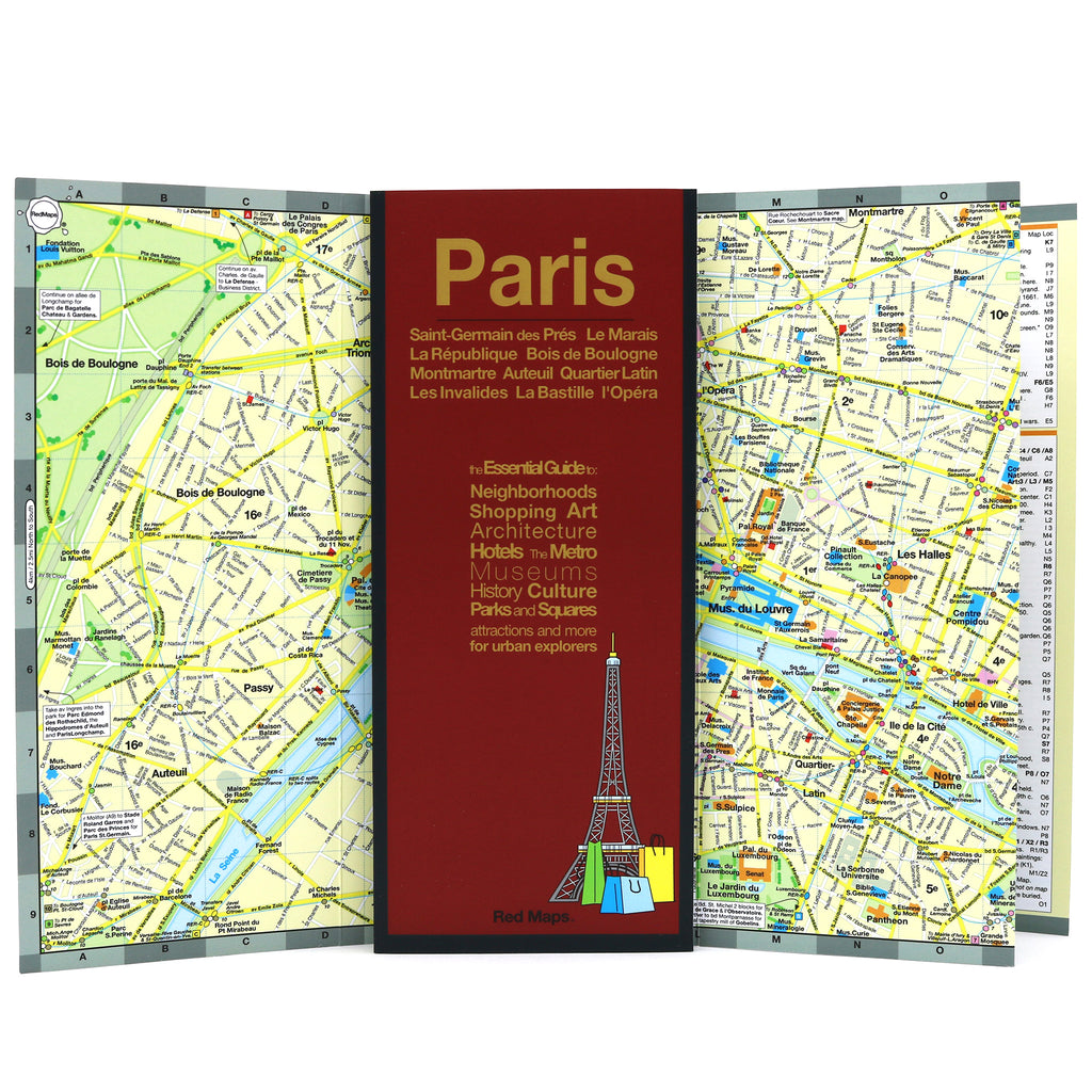
PARIS Travel Map & City Center Guide
Wander the Historic Avenues of the City of Light
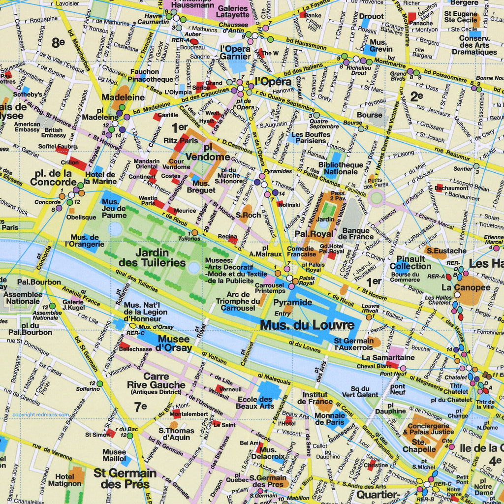
There is nothing quite like wandering the historic avenues of the City of Light, but navigating its winding streets on a small phone screen can mean missing the sweeping architecture right in front of you. This beautifully designed, pocket-sized map gives you a complete, birds-eye view of central Paris. Explore the city from the Right Bank to the Left Bank effortlessly.
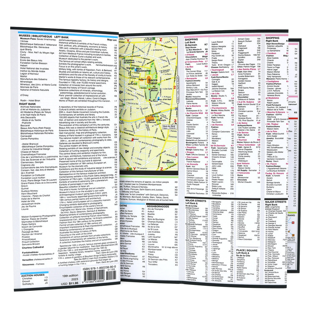
CURATED SIGHTS, MUSEUMS & SHOPPING
Top historic landmarks and must-see sights in Paris.
Curated visitor info and essential attraction guide facts.
Major Paris museum highlights and art galleries.
Boutique hotels and central Paris accommodation landmarks.
Elegant public parks, historic squares, and iconic gardens.
Right & Left Bank designer boutiques, historic shops & antique flea markets.
Streets, historic avenues, and boulevards clearly identified.
Paris Metro stations, subway lines, and transit routes.
Legendary theatres and major sports stadiums.
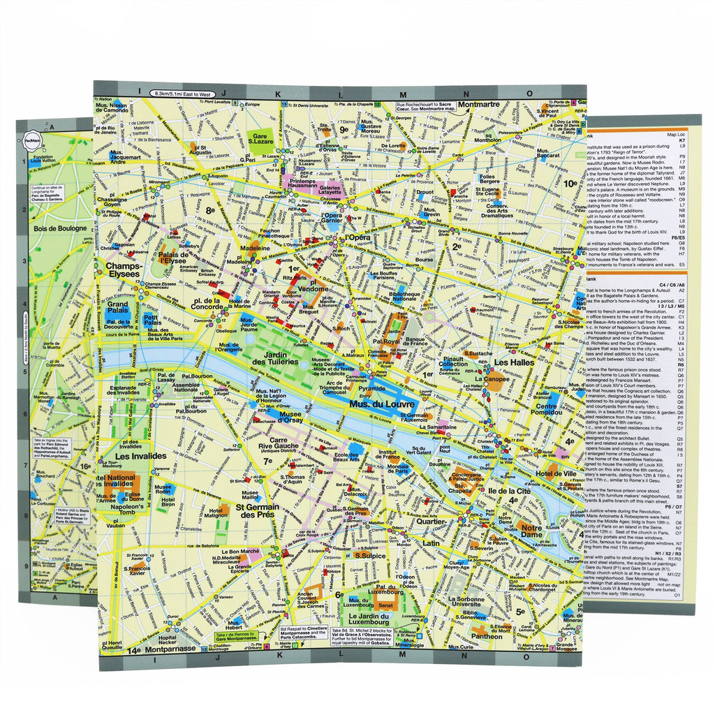
NEIGHBORHOODS & ESSENTIAL TRANSIT
Paris is a grand tapestry of distinct historic districts and neighborhoods. This map cleanly outlines and labels the city center’s most vibrant areas, making it a breeze to plan your daily walking routes. On the map are:
Le Marais, Montmarte, Les Halles, l'Opera, Champs-Elysees, St. Germain des Pres, Latin Quarter, La Republique, Eiffel Tower and Bois de Bologne.
MAP DIMENSIONS & MATERIALS
Opens to 24 in. wide x 9.5 in. tall; 61 cm x 19 cm
Map folds to a compact 4 in. wide x 9.5 in. tall; 10 cm x 24 cm
No-glare matte finish, easy-to-read map both indoors and the mid-day sun.