


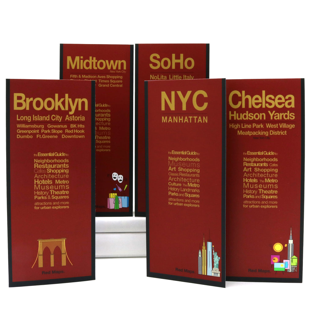


New Yorker 5-Map Set: NYC Neighborhood Street Maps
The Essential Foldout Street Map Set of New York City
Experience the city like a native with essential collection of NYC neighborhood street maps. this specialized set brings together Red Maps curated coverage manhattan Brooklyn Midtown Chelsea and Soho. meticulously designed for independent travelers urban explorers design enthusiasts each map offers an unparalleled big-picture view most vibrant cultural hubs complete clear block-by-block detail.
FEATURED NEIGHBORHOODS ON THE MAPS
Hudson Yards, High Line, West Village, Tribeca, Williamsburg, Dumbo, Nolita, Little Italy, Financial District, Greenwich Village, Chinatown, Upper East Side, Upper West Side, Greenpoint, Park Slope, Long Island City, and Astoria Queens.
WHAT'S INCLUDED IN THE NEW YORKER 5-MAP SET
Popular attractions & points of interest.
Museums with collection highlights.
Landmarks & monuments with historical facts.
Subway stations and routes.
Hot and legendary restaurants, cafes & bars.
Over 1,000 boutiques, luxury brands and local shops.
Centrally located hotels.
Stadiums, theaters & arenas.
Parks, gardens & zoos.
AS SEEN IN AND RECOMMENDED BY
Travel + Leisure, The New York Times, British Vogue, Harper’s Bazaar, Condé Nast Traveller, ELLE, Wallpaper*, Town & Country, The Washington Post, The Wall Street Journal, Highsnobiety, and Madame Figaro — among over 100 purveyors of style, travel & design.
MAPS’ DIMENSIONS & MATERIALS
Each map opens to 24 in. wide x 9.5 in. tall | 61 cm x 19 cm.
Each map folds to 4 in. wide x 9.5 in. tall | 10 cm x 24 cm.
No-glare finish makes Red Maps easy-to-read indoors and outdoors.