


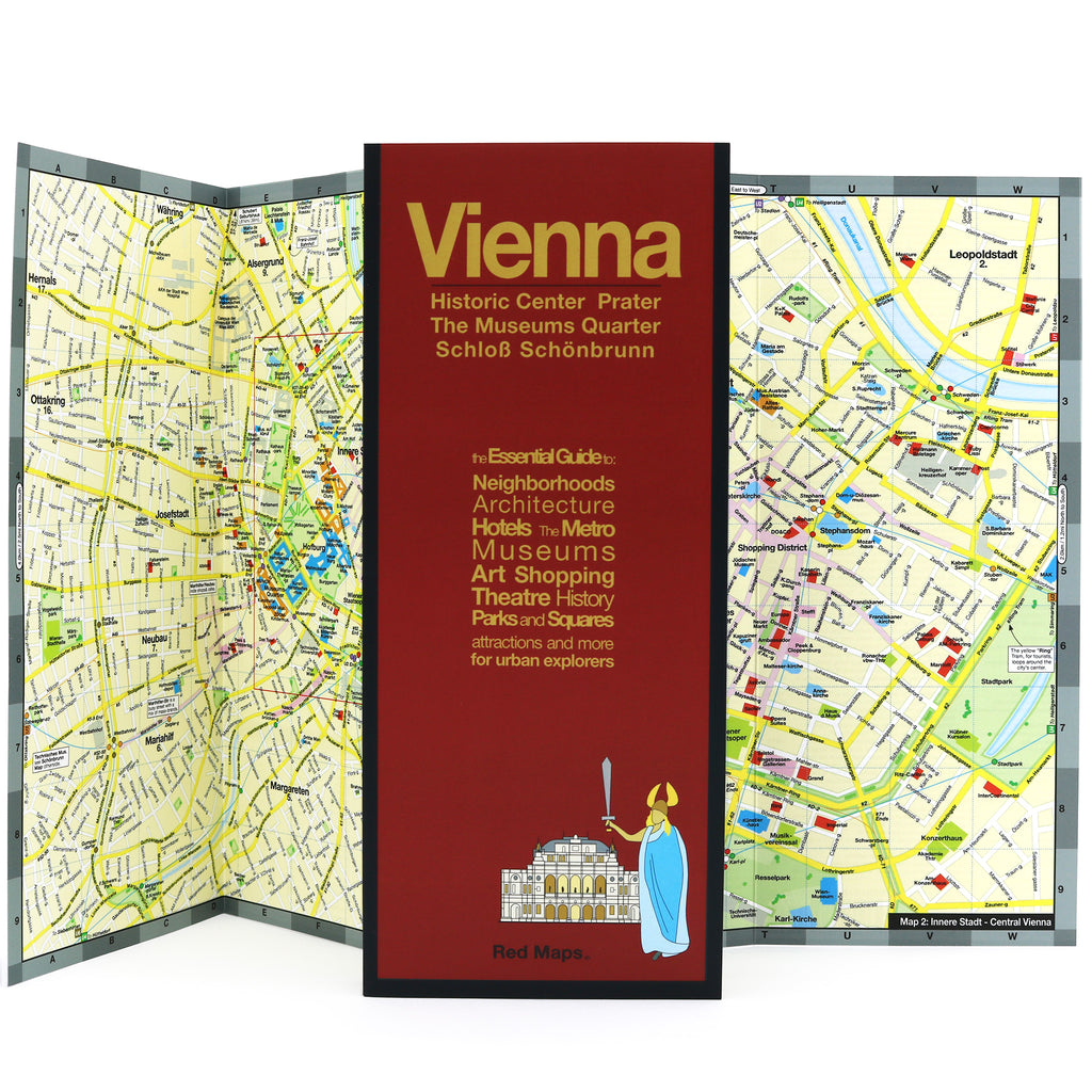

VIENNA City Center Map
Foldout Travel Map of Vienna
Laminated pocket-sized map of central Vienna shows you in one easy-to-read colorful map everything you'll want to see in this enchanting city.
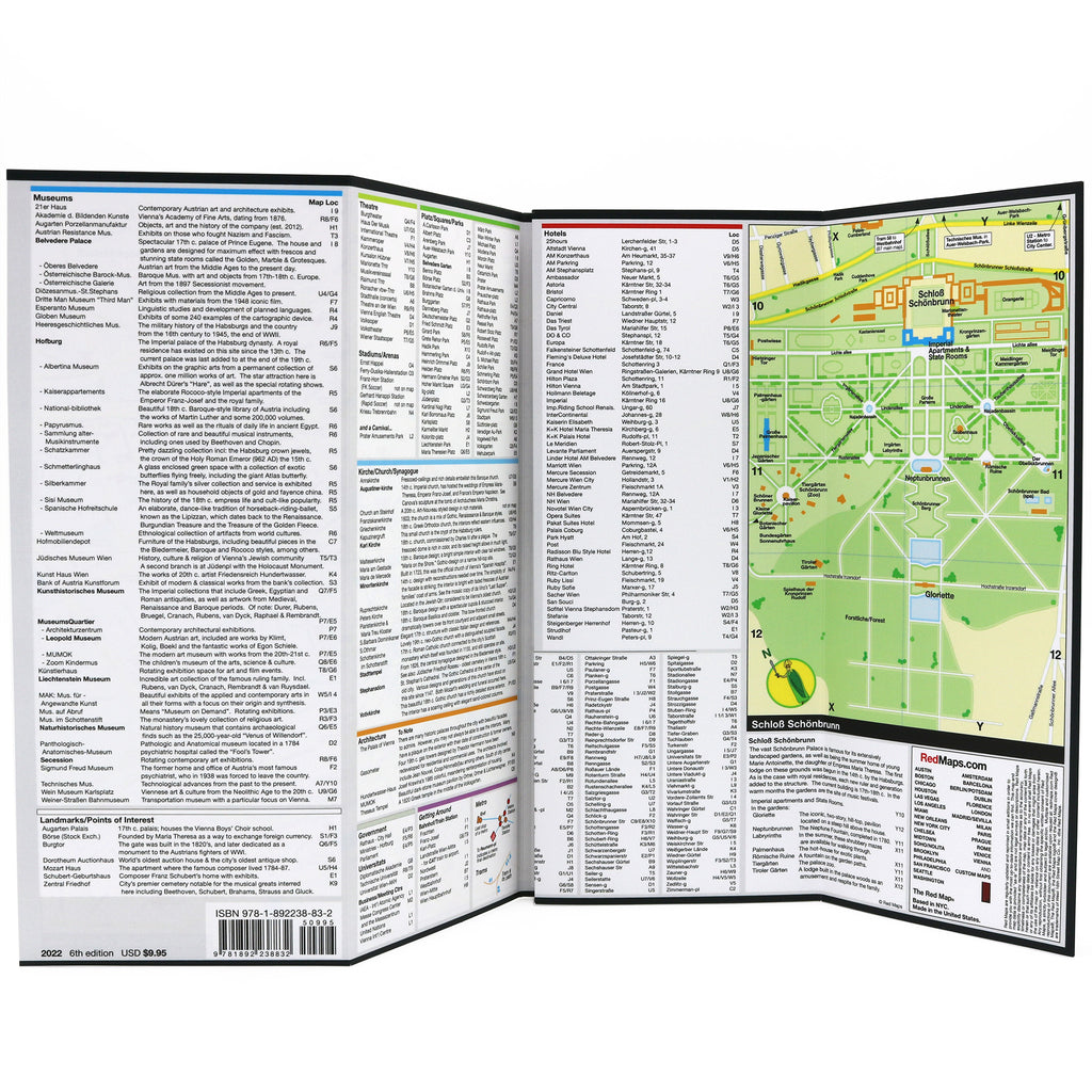
Information on the Map Includes:
Important historical landmarks.
Useful facts about popular attractions.
Museum collection highlights.
Schonbrunn Palace and Gardens
Central Vienna boutique hotels.
Shopping boutiques.
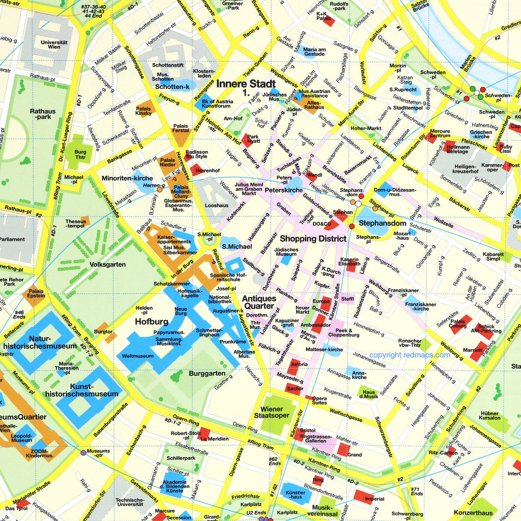
Streets and squares clearly identified.
Metro and Tram stations and routes shown on map.
Parks, theatres and the Vienna’s Hapsburgs palaces.
Neighborhoods on this Map
Vienna Red Map shows these neighborhoods: Historic central Vienna, Innere Stadt, Leopoldtstadt, Prater, Josefstadt, Nebau, Mariahilf, Margareten, Wieden, Alsergrund and the Messe-Congress.
Map Dimensions
Opens to 24 in. wide x 9.5 in. tall; 61 cm x 19 cm
Map folds to 4 in. wide x 9.5 in. tall; 24 cm x 19 cm
>No-glare matte finish, easy-to-read map indoors and outdoors.